
Find out more about the hiking trails in Himos and nearby.
HIKING TRAILS OF HIMOS
Himos hiking trails are within arm’s leght from every cottage in the area. The marked trails offer safe choices from moderate to demanding level of fitness with added pleasure of beautiful scenery from the hilltops. Grab a map from the Himos reception and plan your own adventure.
If you don’t want to go on a hike independently, we can organise guided nature and hiking trips with our local partners.
For additional information, contact Himos Holiday.
Rent an eFatbike, Nordic Walking poles or snowshoes, the price list for rental equipment can be found from rental.
Ask for your copy of the printed map from the Himos reception!
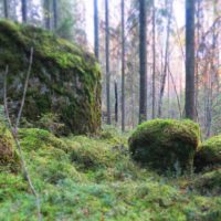
HIMOSHUIPPU TRAIL
Himoshuippu trail is 6 kilometers (3.73 miles) long. The starting point of the trail is in the top of Northern Himos. The trail is used as a skiing track in the winter, so it is well marked and accessible. The trail has two camp fire places where you can have a break and enjoy your snacks. There is a parking lot in the starting point where you can leave your car.
You can also start your hiking under the Northern slopes and climb all the way up. The track up is 1,8 kilometers (1.12 miles) long.
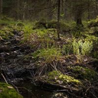
HUIPPU FOREST TRAIL
The trail in the top of Himos, Huippu forest trail, is 4 kilometers (2.49 miles) long. The trail is well marked with red points in the trees and rocks. The starting point for this beautifully landscaped trail is at the top of the Northern Himos. There is also one camp fire place along the trail for hikers to use.
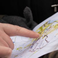
PALJAKKA
Paljakka trail is 4,4 kilometers (2.73 miles) long trail in the beautiful Central Finnish forest. Good starting point is from the camp fire place under the children’s slopes. From there the trail to Paljakka is about 1,5 kilometers (0.93 miles) long. The trail is marked clearly with yellow markings on trees and rocks.
In addition to the camp fire place at the start, there is a another also in the midst of the coniferous forest.
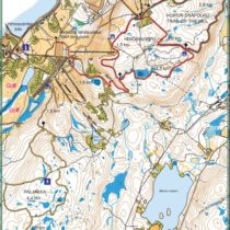
SAMMALSUO
Sammalsuo trail is 3,3 kilometers (2.05 miles) long. It is an excellent trail to add to Paljakka trail, together these two trails make a 11 kilometer (6.84 miles) long hiking trail.
KIVILAAVU TRAIL
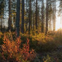
Kivilaavu trail is 12 kilometers (7.46 miles) long trail. It is partly unmarked. Half of the trail from Honkaranta to the Kivilaavu, Rock wicket, is marked and the other half from the camp fire place to Himos Center is not.

OTHER HIKING SPOTS NEARBY
Jämsä and the nearby towns have many unique and impressive nature sites.
The nature has done its best in these hilly and forested attractions.
ISOJÄRVI NATIONAL PARK
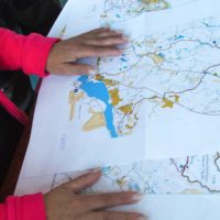
The hidden wilderness treasure Isojärvi offers rugged ravine valleys, vast forests and a clear watered streams and lake. The National Park is a great place for a day tour from Himos or even an overnigh. An extensive 30 km trail network is marked and you can choose also between nature paths that tell more about the natural wildlife in the area, or of its history and living conditions for lumberjacks who used it as an important source for wood.
It is possible to rent kayaks, fatbikes, tents and other hiking equipment from the Heretty lodge cafeteria.
Find out more from the web-page: ISOJÄRVI »
Check out the beautiful pictures from Isojärvi from the blog Notskilla: BLOG NOTSKILLA »
JUVENINKOSKI WATERFALL
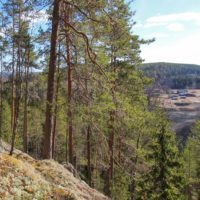
Almost 7 m. vertical waterfall is at its best in the spring time when the snow melts and the water runs with roaring sound and creates white headed cascades. The rapid is known to be the highest free falling waterfall in Central Finland and conveniently located in the middle of a small local village of Partala. Rapids in the village were an important asset for felt factories hundred years ago when Jämsä was one of the hubs of felt industry with 7 working factories in the village. Some still remain, why not make a day out of it and visit the felt shop for traditional long legged felt boots?
More information in HimosJämsä web-page: JUVENINKOSKI »
Amazing pictures from Juveninkoski in the blog Notskilla: BLOG NOTSKILLA »
STRUVE
Struve geodetic arc was established by German-born Russian genius scientist Friedrich Georg Wilhelm von Struve in 19th-century. The arc represents the first accurate measurement of the meridian length, helping humans to realize the exact size and shape of the earth. Building of it took 39 years starting from 1816. The arc consisted of 265 continuous measurement points accross 10 countries and 2820 km from the Arctic Sea to the Black Sea. 34 Arc Points have been accepted into the Unesco World Herigate List since 2005. The most famous Arc Point in Finland, Oravivuori is just 30 minutes from Himos. The triangular point on a high hill guarantees amazing views to Lake Päijänne. The place is a great place for self guided adventure but guided tours are also available.
Check out more information National Land Survey of Finland: STRUVE »
HUNGRY FOR MORE?
Jämsä is full of attractions that have been moulded by the great powers of terrestrial movement and time. Many of them have been a shelter or hide-away for our ancestors and vivid folk tales still inspire imagination. Find approaching instructions to Synninlukko – a mysterious gorge valley or impressive water-shed gorge Vororotti at HimosJämsä web-page. Enjoy the atmosphere through the lenses of expert photographers at Notskilla photo-blog.
Link to HimosJämsä web-page: MORE NATURAL INFO » HIKING IN NATURE »
Link to blog Notskilla: BLOG NOTSKILLA »

Welcome to Himos Holiday!
HimosHoliday | +358 20 711 9230 | himosholiday(at)himosholiday.com

